The review of the North Nandi Participatory Forest Management Plan was conducted through a consultative process, coordinated by the County Forest Conservator’s office in Nandi, with financial support from the French Development Agency (AFD)
through the Green Belt Movement (GBM). The process began on September 28, 2021, at the Forest Manager’s compound in North Nandi, leading to the formation of a Local Plan Review Team, including community members from six beats, KWS representatives,
and the Forest Manager.
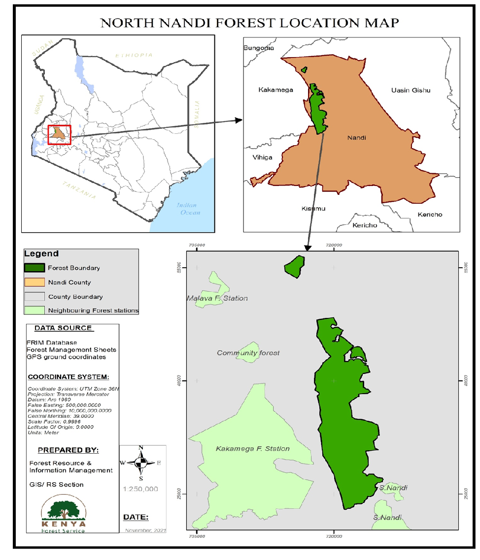
Nandi North Forest, covering 10,500.7 hectares in Nandi County, was declared a forest reserve in 1936 and later a central forest in 1964. It spans Nandi North and Chesumei sub-counties, bordering South Nandi, Kakamega, and Malava forests.
Managed by the Forest Station Manager with support from KFS staff, it lies at an altitude of 1,900–2,250 meters above sea level. The first Participatory Forest Management Plan (PFMP) was established after the 2005 Forests Act and launched
in 2016, covering five years until 2020.
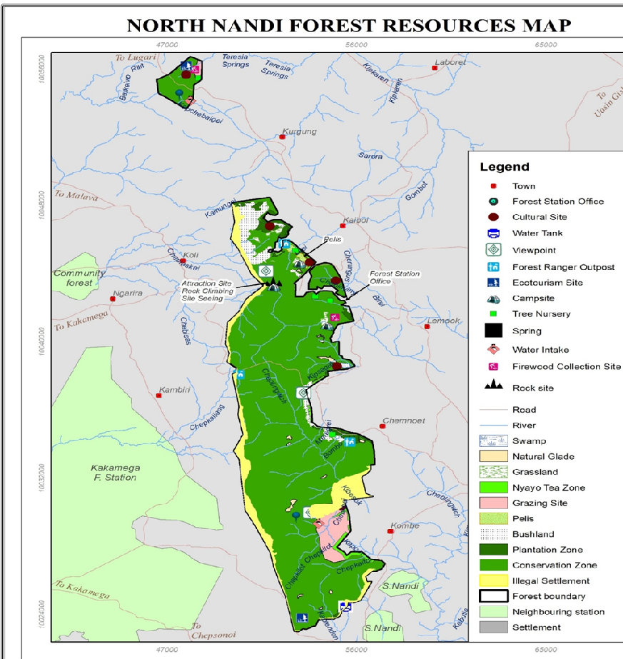
The Forest falls within the range of at an altitude of between 1,900 and 2,250 m asl. In 2016 the forest had prepared a Participatory Forest Management Plan (PFMP) after the Forests Act 2005 was enacted and operationalized in 2007. The PFMP
last one was launched in 2016 by the Director KFS which covered a period of 5 years effectively elapsing in 2020.
Nandi North Forest, covering 10,500.7 hectares in Nandi County, was declared a forest reserve in 1936 and later a central forest in 1964. It spans North Nandi and Chesumei sub-counties, bordering South Nandi, Kakamega, and Malava forests.
Managed by the Forest Station Manager with support from KFS staff, it lies at an altitude of 1,900–2,250 meters above sea level. The first Participatory Forest Management Plan (PFMP) was established after the 2005 Forests Act and launched
in 2016, covering five years until 2020.
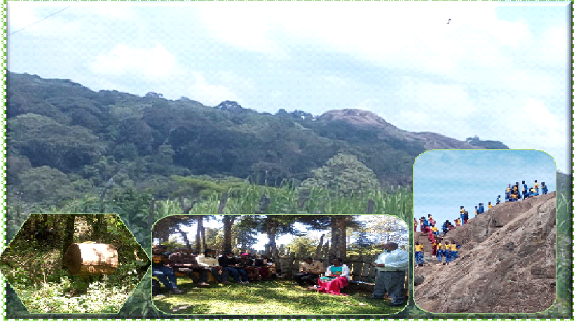
The review involved key stakeholders assessing previous plans through literature reviews, surveys, direct observations, and community consultations. A Local Plan Review Team (LPRT) provided essential input, and trained enumerators conducted
a socio-economic survey in November 2021. The collected data was organized into various management programs, including forest conservation, plantation development, water resource management, eco-tourism, security, community participation,
infrastructure, human resource development, and research.
The five-year plan includes estimated budgets for each activity, aiming to conserve and sustainably manage Nandi North Forest while improving the livelihoods of adjacent communities. It also emphasizes the role of women, youth, and people
with disabilities in conservation efforts.